Council’s Blenheim office will be closed from 4.30 pm Thursday 17 April and will reopen on Tuesday 22 April at 8.30 am. See details of transfer station opening hours and kerbside collections

Council’s Blenheim office will be closed from 4.30 pm Thursday 17 April and will reopen on Tuesday 22 April at 8.30 am. See details of transfer station opening hours and kerbside collections


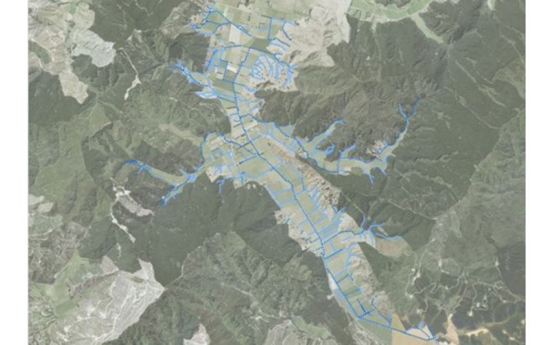
Are Are Creek is a Northbank tributary of the Wairau River. Its headwaters originate in Okaramio and its mainstem flows alongside State Highway 6, through the Kaituna valley, before joining the Wairau River downstream of the SH6 Bridge.
The Are Are Creek catchment has an area of 31.4 km2. Production pine forest dominates land cover in the elevated parts of the catchment (47%), and pasture dominates land cover in the lower elevations (27%). Smaller areas of the catchment are covered by native forest and shrubs (18%) and vineyards (6%).
Monitoring data collected as part of the State of the Environment (SoE) program from the lower reaches of Are Are Creek have shown that the river has poor water quality. Concentrations of Dissolved Inorganic Nitrogen (DIN) consistently exceed guideline levels for prevention of nuisance algal growth and concentrations of Dissolved Reactive Phosphorus (DRP) and E. coli frequently exceed guideline levels for nuisance algal growth and contact recreation, respectively.
Go to the State of the Environment reporting page
Are Are Creek has shown a noticeable improvement in water quality (and therefore WQI bands) since the last monitoring period. This is mainly due to a significant direct discharge being identified as part of the catchment study and subsequently removed. Land use change has also resulted in improved water quality in the catchment.
Trend analysis for Are Are Creek shows small reductions in Dissolved Reactive Phosphorus and turbidity, but significant improvements in E.coli concentrations.

Are Are creek catchment with waterways shown.