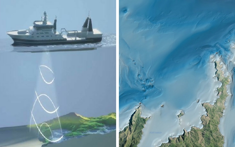
With mountains and valleys, canyons and plains, and ridges and reefs - the seabed is as complex as the land.
There are many different habitats in Marlborough's coastal waters. These have been formed over eons by geological processes, and by the power of tidal forces scouring out deep channels and sculpting sediment waves.
Marine biodiversity is associated with different habitat types. To better manage human activities on marine ecosystems, Council needs a good understanding of where areas hosting high biodiversity are located.
In 2015, Council commissioned NIWA to map an extensive area of seabed off Northwest D'Urville Island/Rangitoto Ki Te Tonga.
In 2016, Council and Land Information New Zealand joined together to fund a survey by NIWA and Discovery Marine of Queen Charlotte Sound/Tōtaranui and Tory Channel/Kura Te Au.
The mapping is done by state of the art multibeam echosounder technology.
Multibeam echo sounders produce a fan of acoustic beams or sound waves' directly downwards from the bottom of a boat. These beams reflect off the seafloor, enabling the surveyors to calculate the depth of the seafloor and scan and map the seafloor habitat in great detail.
The three dimensional habitat maps created identify features such as reefs and canyons, which can then be targeted for sampling with underwater video and camera technology to build up a picture of the ecological conditions and species present.
That is important visual information for Council and the community to make good management decisions.
To find out more email Council's Coastal Scientist


